NOTE: These are informal notes and started from a discussion on Guildford Town Past and Present facebook. I really enjoyed it and did a bit of a trawl on the internet. I found lots more information which I have pulled together here. I hope people don’t mind me using their quotes. It is a series of notes and I will add to it if and when I or anyone else shares information. It is a bit of a time consuming exercise and there has not been time to double check everything – I just thought it would be a good idea to pull this stuff together
Today Haydon Place is most notable as the home of Waitrose built about 2015. It lies to the north of North Street and is an interesting area because it has been a mixture of grand houses, industry, community facilities and residential housing.
Joseph Haydon was an alderman in the mid nineteenth century (more information needed)
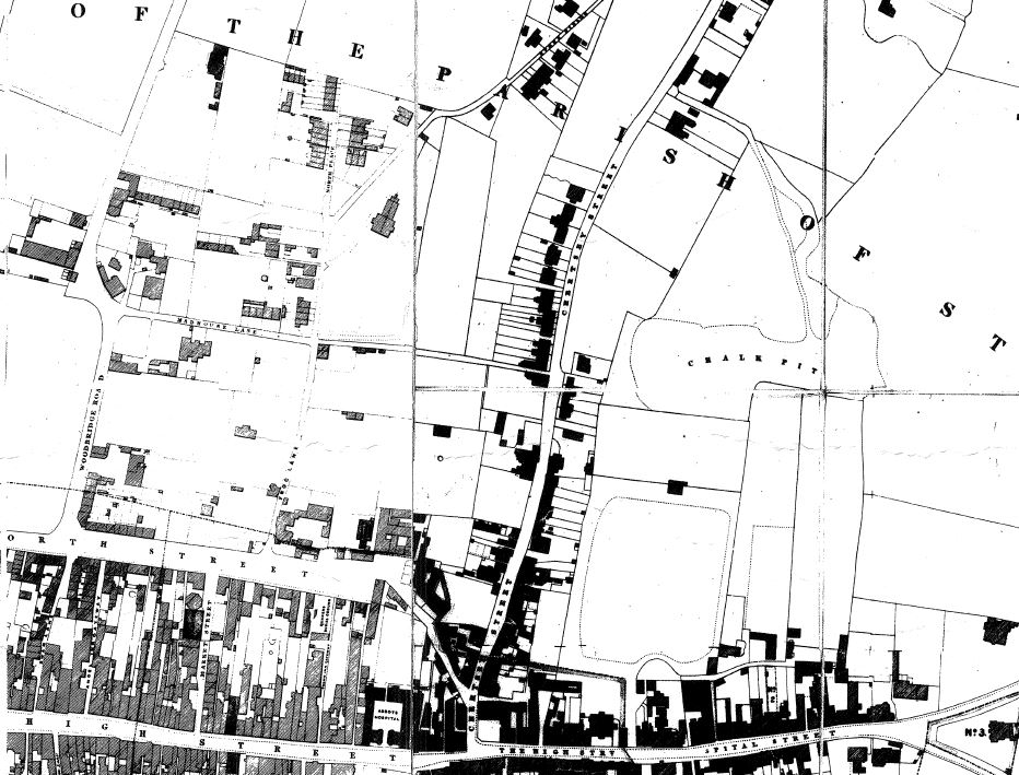
The Witherby Map of 1827 shows the area as it was starting to develop. Modern York Road cuts across the top of the map just below the words “The Parish”. There are some terraces but also some large houses such as East Sandfield House
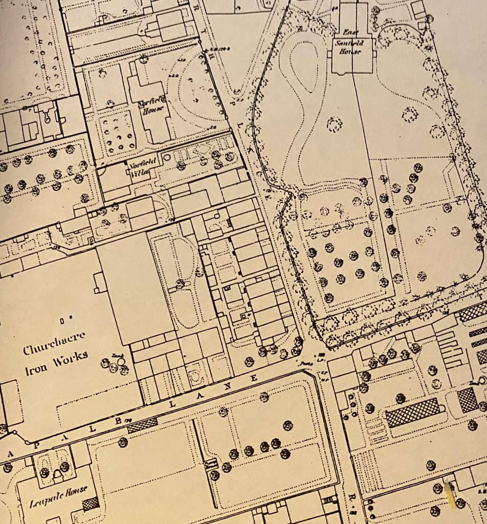
These houses are more visible in the 1870s OS map below. East Sandfield House is clear and to the left is Northfield House on the site of the Waitrose car park. From the look of things it survived into the early 20th century. It is on the 1916 OS map but not he 1934 map.You can see the gardens laid out. There is Northfield Villa and further down Leapale House. Northfield House is interesting because (if I am correct) I have childhood memories of it being a bakery in the 1970s. We were taken on a school trip to see it. I remember the wonderful smell as you walked past and inside I remember a lady showing us how she made a platted loaf by hand.
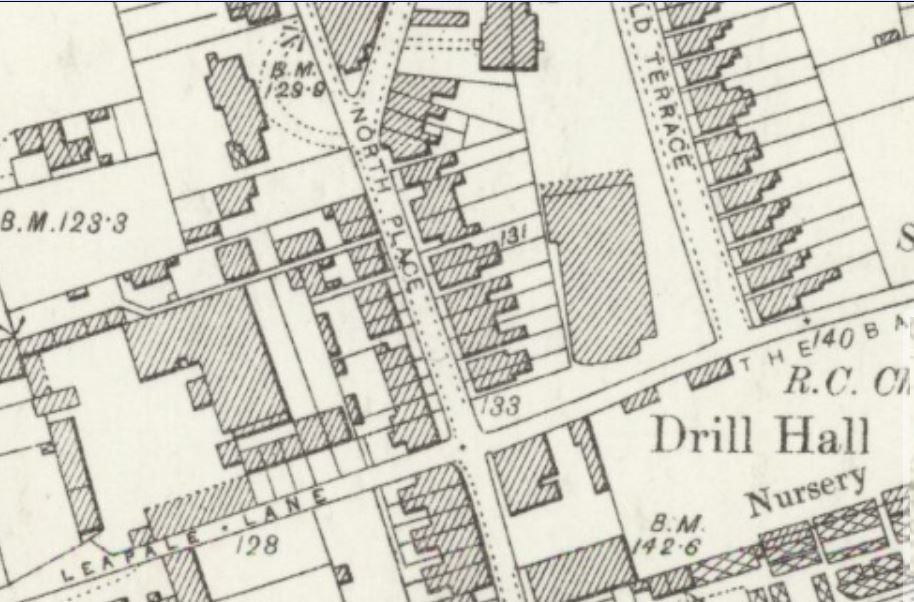
By the 1896 OS Map much of this area was being built over for terrace housing as Guildford grew. The drill hall has appeared – there was an interesting discussion about this in Guildford Past and Present but I cannot find it.
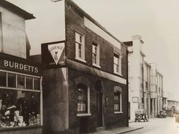
Some wonderful photos were shared in Guildford Past and Present which I have put here.


In the background is what I believe to be the bakery rising above the other buildings.
Julia McShane wrote in Guildford Town Past and Present “My Dad was thrilled to see this pic and reeled off the names of the people who lived in the houses on the left. He recalled the Turners, Sherwins, Mr & Mrs Cose, Taylors (Mr Taylor drove a steam engine and used to park it in the street when he came home for his lunch. My Dad and his best friend next door used to love to see it) The next house was the Miles family, then the Smiths (my Dad and his parents), Wheelers, Jelley family, Dinsdales. There was then a shop run by Miss Burdett and next door to that was the Live and Let Live pub run by Mr Knight. My Dad recalls the cottages were owned by Col. Barker and that they weren’t in the best of repair. The tenants eventually had to be rehoused and in 1960 my dad and his mum were rehoused in a prefab in Chapelhouse Close.”
Sheila Atkinson writes “My Aunt and Uncle lived in Leapale Lane and my Cousin was born there in 1950. Oddly enough my Cousin’s life centred mainly around that area, the family moved to Leapale Road. When my Cousin went out to work he worked for the Surrey Ad. in Martyr He married and moved out of Guildford but sadly he died at the age of 44 in the RSCH. When I went with his wife to register his death the Registry Office at that time was in College Road almost back to where he was born.”
This is the same view in 2021 (Google Maps)

This next view below is from Britain From Above . Haydon Place crosses the middle of the image from left to right and Leapale Lane comes up from the bottom. It is a shame the Arts and Craft style shops on the corner of Haydon Place are no longer there. These are dated after the vintage image above. Just above them in Martyr Road is the old Art Deco Surrey Advertiser building.
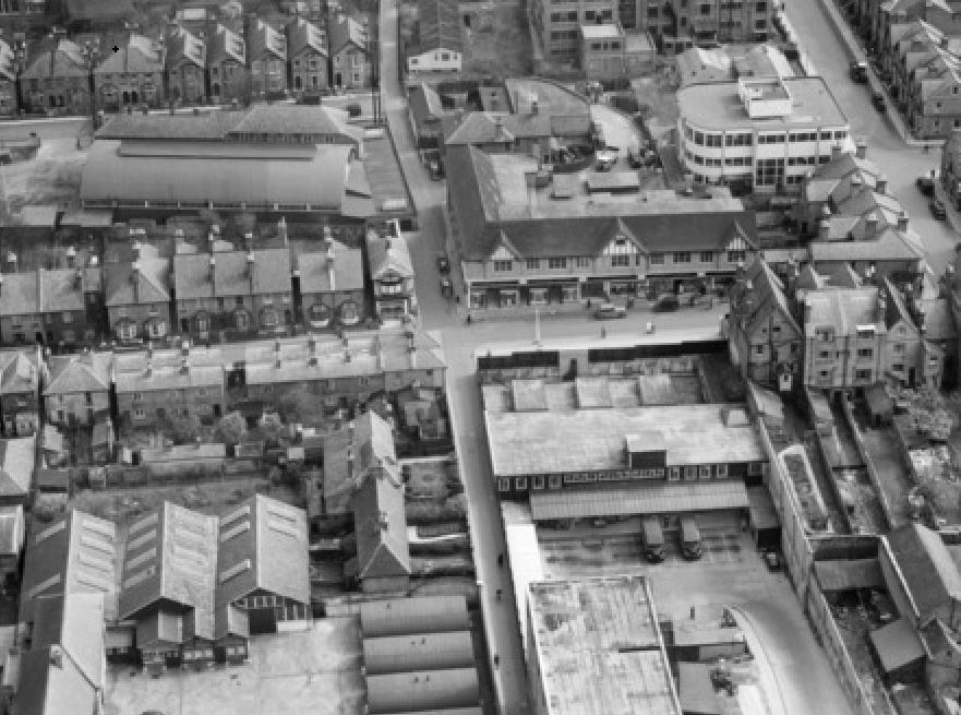
The bottom left hand corner of the image is Dickinson & Burne’s engineering workshop according to an amazing article in derelictplaces.co.uk. Many people will remember this as the Bellerby Theatre. According to the article, the Bellerby Theatre was a Victorian two story, brick school building with later additions.

I quote from the article “In the early 1900’s it took the form of Dickinson & Burne’s engineering workshop, the below pic shows the window-rattling tradition of anvil firing on special occasions with this occasion being celebrated on coronation day, June 22, 1911.
Five anvils are seen to represent the fifth King George. In the picture they are upturned to expose the casting slot in the base that serves as a touch hole, its charge of black powder rammed firm with a wooden plug and fused. The firing master stands back, ignition rod glowing after a plunge in the portable brazier behind him.
The works were requisitioned by the military for the Royal Electrical and Mechanical Engineers’ (REME) workshops during the Second World War and at some stage, the building was renamed the Electricity Theatre when it first opened as a centre for arts and drama.
In 1978 after a refurbishment it was renamed the Bellerby Theatre, seating 150 people. In 1983 the lease of the Bellerby Theatre was taken up by Guildford School of Acting, until reaching its final demise of complete demolition for a new Waitrose.

A archaoelogical survey by the Surrey Archaeological Society provides more information (https://www.surreyarchaeology.org.uk/content/bellerby-theatre-leapale-lane-guildford)
“L-shaped block of one- and two-storey brick buildings, with four broad phases of development identified. The earliest component represented buildings established c 1868 as part of the Filmer and Mason Ironworks. By 1881 the site was known as Church Acre ironworks and a number of small extensions were added in the period 1881–96. The ironworks ceased operation in the 1920s and the site was later occupied by the army. From the 1930s onwards, extensions to the ironworks were demolished in the northern part of the building complex, and replaced by a range of two-storey brick buildings. These buildings previously extended beyond the western site boundary but the range was reduced in length after 1963 to their present form. In the late 1970s a local theatre group took over, which gave the site its name. Since the early 1980s the buildings have been used by Guildford School of Acting and the interiors of the buildings adapted to fit this purpose with the result that very few earlier features have survived.“
This next image is from Britain From Above (https://www.britainfromabove.org.uk/cy/image/eaw022668). I have circled the presumed bakery on the site of the Waitrose car park which appears on the 1934 OS Map. Just to the left of the circle is what I imagine is East Sandfield House. At the bottom of picture is York Road before it cut through the houses to create the modern route.

To return to Waitrose. The site of the car park was a retirement home in the 1970s presumably after the bakery was demolished. I played in a brass band at that time at Sandfield School but have no recollection of the bakery no longer being there or of the retirement home. Mind you it was dark when I went home.
This picture of the retirement home was posted on Guildford Town Past and Present . Peter Blow says “I remember in the mid 70s, before they built the retirement flats that are now Waitrose carpark, there was an open piece of land that we referred to as the overflow carpark. We used to park there for shopping. There was a bald chap in a hut who took your parking fee, much like the old carpark above TGIs used to do”

Waitrose itself was the site of the Guildford Youth Centre which I do remember going to – a busy smokey place with lots of teenagers playing snooker is all I remember. It was apparently built in 1963
